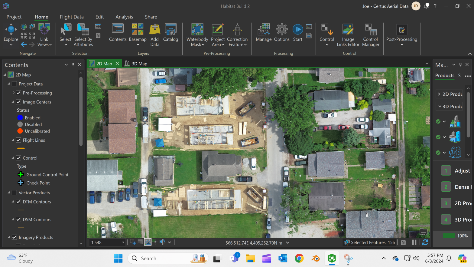
Aerial Data for Accurate Progress Tracking (construction)
For our construction clients, Certus Aerial employs advanced aerial capabilities to ensure precise and efficient project management. We transform aerial data into detailed, actionable insights, offering an innovative blueprint-to-reality approach that greatly aids in accurate progress tracking and informed decision-making throughout the construction lifecycle. Our integration of high-resolution aerial imagery and advanced data analysis streamlines project timelines and boosts the accuracy and efficiency of resource allocation and site management, without stepping into the realm of legal land surveying.

Our dedication to precision in each flight and analysis positions Certus Aerial not merely as a service provider, but as a strategic partner committed to realizing complex construction projects with a high standard of excellence, complementing the work of traditional surveying services. Our drone-based services provide:
- Detailed Site Monitoring: Comprehensive aerial views for accurate project tracking.
- Schedule Adherence: Regular updates to monitor progress against project timelines.
- Budget Compliance: Aerial insights to help manage resources and control costs.
- Volume Calculations: Precise measurements for earthwork and material management.
- Safety Enhancements: Identifying potential hazards to maintain a safe construction site.
With these services, we assist in maintaining project accuracy, ensuring adherence to schedules and budgets, and providing critical data for effective decision-making in construction projects.

From Blueprint Vision to Construction Reality
Redefine your construction project by seamlessly bridging blueprints to reality. With Certus as your technological partner, witness an efficient transformation, as we provide precise insights for timely and informed decision-making.
- Accurate Project Monitoring
Our high-resolution aerial imaging sets the stage for real-time, accurate project monitoring, providing a bird’s-eye view of every facet of your construction site. From tracking progress and identifying potential bottlenecks to ensuring compliance with design specifications, our technology offers unparalleled precision.
- Blueprint to Reality Integration
Our high-resolution aerial imaging captures the intricacies of blueprints with unparalleled accuracy, providing a comprehensive foundation for project execution. Leveraging intricate 3D modeling, we offer a detailed and immersive visualization of your construction plans. This not only enhances accuracy in progress assessment but also serves as a valuable tool for stakeholders to gain a thorough understanding of the project’s intricacies.
- Drone Precision Mapping
Leverage the precision of drone technology for unparalleled mapping accuracy in construction projects. Certus Aerial Data employs advanced drones equipped with cutting-edge sensors and cameras to capture detailed and high-resolution aerial imagery. This data is then meticulously processed to create precise maps that ensure the alignment of blueprints with real-world execution.
- Construction Site Insights
Our high-resolution aerial capabilities offer a comprehensive view of the construction site, enabling proactive identification and resolution of potential issues. From monitoring site logistics to assessing structural integrity, our aerial imaging ensures a detailed understanding of the construction environment. This precision allows for strategic decision-making, early issue detection, and seamless coordination among teams.
- Enhancing Efficiency
By harnessing technology-driven data, we revolutionize the utilization of materials and manpower throughout the construction process, ensuring every resource is maximized efficiently. Our technology allows for real-time monitoring and analysis, offering a comprehensive view of the construction landscape. This, in turn, empowers project managers and stakeholders to make informed decisions promptly.


