
About Certus
At Certus Aerial Data, we believe in converting intricate spatial data into actionable insights through GIS (Geographic Information Systems). Our expertise lies in creating detailed, layered geospatial maps vital for diverse applications, from urban planning to environmental management. Our integration of BIM (Building Information Modeling) enhances our services, delivering architects and engineers with 3D models that seamlessly integrate geospatial data with real-world building designs. Choose Certus Aerial Data for precision and innovation in spatial information solutions.
Certus Precision: Eliminating the Guesswork with Data Excellence
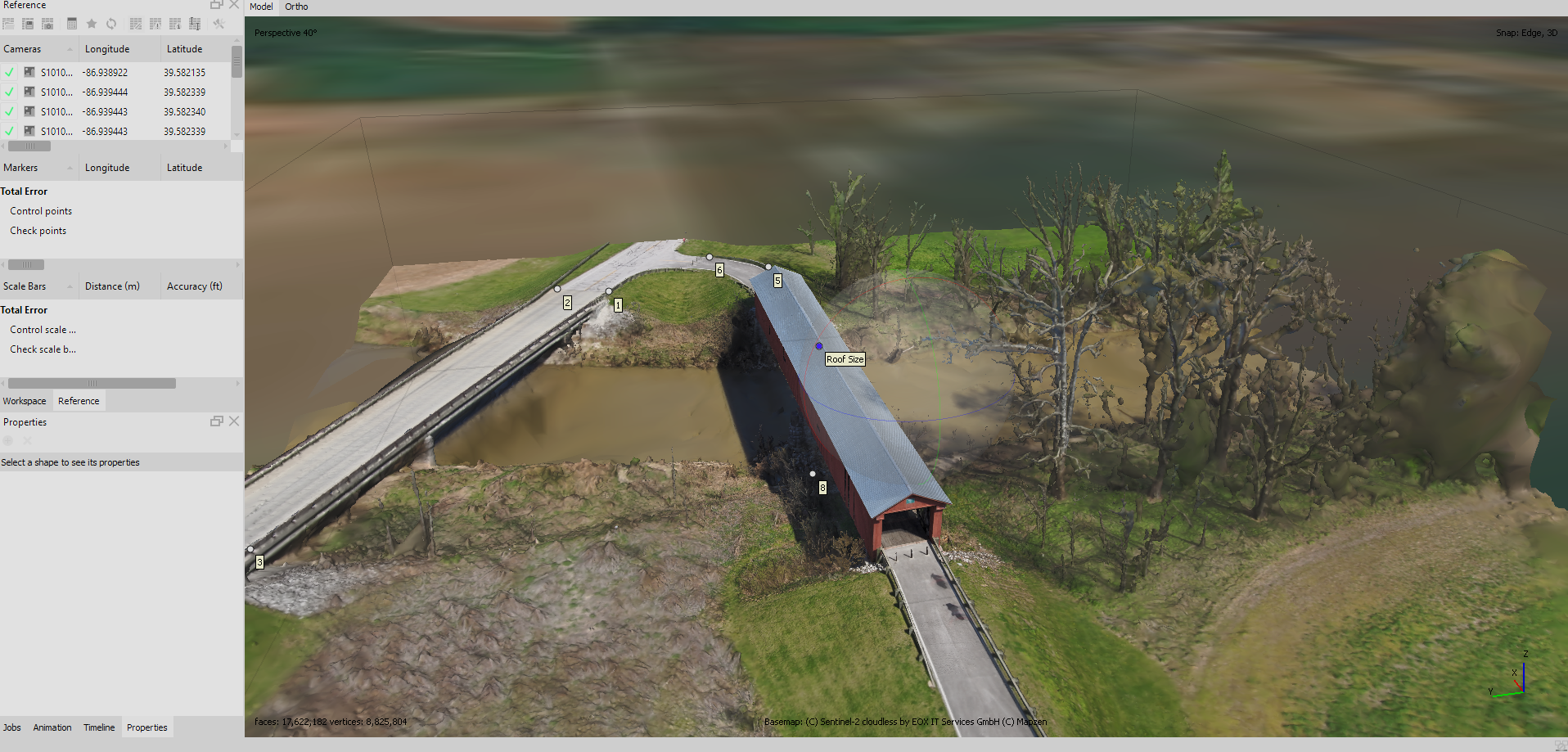
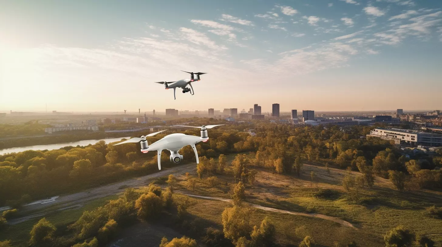
In the realm of construction projects or expansive farmlands, the need for accurate and timely data is paramount. Certus Aerial Data stands as your strategic partner, providing a transformative experience with our advanced drone technology. Our drones, equipped with RTK technology, capture high-resolution aerial images, seamlessly transforming them into precise 2D maps and 3D models. Explore the advantages of Certus Aerial Data, where data is not just collected; it’s fast, accurate, and actionable, changing the game in construction and agriculture.
- Our advanced drones feature RTK technology for unparalleled accuracy in data capture.
- Capture detailed and high-resolution aerial images, forming the foundation for precise mapping.
- Utilize cutting-edge technology to transform captured images into precise 2D maps and detailed 3D models.
- Certus Aerial Data delivers data that is not only fast but also accurate and immediately actionable, empowering data-driven decision-making in construction and agriculture.
Experience Excellence with Certus Aerial
At Certus Aerial, we seamlessly blend academic expertise with real-world experience to excel in providing exceptional aerial services. Our roots lie in a distinguished military career and extensive academic pursuits. This founder has passionately channeled a deep-rooted interest in drone technology into the heart of our operations.
- Academic Excellence
Our founder brings a wealth of knowledge with a Master’s Certificate in Homeland Security and Emergency Management from Indiana University and academic studies at Oxford University.
- Distinguished Military Background
Transitioning from a distinguished military career, our founder has channeled expertise into the heart of our operations.
- Commitment to Redefining Precision
Certus Aerial is not just a company; we are a team committed to redefining precision and efficiency in aerial data collection.
- Sustainable Practices
We prioritize sustainable industry practices, constantly challenging norms, and setting new standards in technological advancement.
We’re not just a company; we’re a team dedicated to challenging norms, setting new standards, and embracing sustainable industry practices. Join us at Certus Aerial, where we’re not just shaping a company; we’re shaping the future of aerial innovation.

“Certus” – A Foundation Built on Certainty and Trust
At Certus Aerial, our name is more than a mere title; it’s a pledge. Derived from the Latin word “Certus,” meaning certainty, sureness, and definiteness, our foundation is rooted in an unwavering commitment to delivering reliable and trustworthy aerial mapping services. In a world fueled by precision and accuracy, we recognize the importance of certainty. Our mission is to instill confidence in every client we serve, ensuring that our commitment to certainty and trust becomes the hallmark of our exceptional aerial services.
At Certus Aerial, we believe in providing excellence and precision to our clients. Our journey revolves around our commitment to providing the best aerial data acquisition. Founded by skilled and Part 107 UAS-certified pilots, we harness cutting edge drone capabilities equipped with real-time kinematic (RTK) technology, which ensures each task is carried out smoothly. At the heart of our operations, meticulous planning and stringent quality control are paramount. Our foremost commitment is to prioritize and cater to our clients’ demands and specifications. Different from traditional land surveying firms, we offer valuable and precise aerial data for different fields without replacing professional land surveying. Going beyond merely providing data, our mission is to deliver insights and customized solutions to meet the unique requirements of each client. We embrace a partnership-driven approach, taking pride in ensuring client satisfaction and achieving successful project outcomes.
Certus Aerial Core Values
Commitment to Precision
At Certus Aerial, we are unwaveringly committed to precision excellence in all our endeavors. Our dedication to delivering accurate and reliable aerial mapping services is anchored in the pursuit of precision, ensuring that every project we undertake meets the highest standards of quality and reliability. Precision is not just a goal for us; it is a core value that defines our approach to every aspect of our operations.
Trust Through Transparency
Trust is the foundation of our client relationships at Certus Aerial. We uphold transparency as a fundamental value, ensuring that our clients are informed and confident in every step of the aerial mapping process. Through open communication, honest practices, and clear project management, we build and maintain trust, fostering long-lasting partnerships built on integrity and transparency.
Innovation and Technological Leadership
Certus Aerial embraces innovation as a driving force in our industry. We value technological leadership and continuously strive to push the boundaries of what is possible in aerial mapping services. By staying at the forefront of advancements in drone technology, GIS, and BIM, we ensure that our clients benefit from the latest innovations, providing them with cutting-edge solutions for their spatial data needs.
Resourceful Stewardship, Lasting Conservancy ?
Environmental stewardship is a core value at Certus Aerial. We recognize the impact of our operations on the environment and are committed to minimizing our ecological footprint. Through sustainable practices, responsible resource management, and adherence to environmental regulations, we aim to contribute positively to the preservation of our planet while delivering exceptional aerial mapping services.
A Gratitude Statement from Certus Aerial to Our Valued Clients
At Certus Aerial, we express our sincere gratitude to our valued clients for entrusting us with their aerial mapping needs. Your experience is at the heart of our commitment to precision. From the initial consultation to the final delivery of your projects, we take pride in consistently upholding our values. Our transparent communication and collaborative project management aim to instill trust throughout our partnership. We believe in not just leading technologically but also embracing environmental stewardship, ensuring a holistic approach to your spatial data requirements. Certus Aerial is more than a service provider; we are your reliable partner in the journey towards spatial data excellence.
Sincerely,
Certus Aerial